
Home > Catalogue > Browse > Map of the North-East States of America << >>
Site

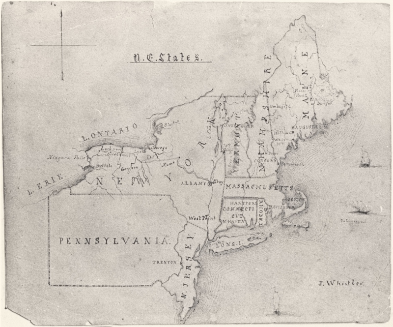
Map of the North-East States of America, Library of Congress
The map shows the north-east states of America, with Lake Erie, Niagara Falls and Lake Ontario at upper left, Maine at upper right, and New Jersey at the bottom. The names of States, some towns, and mountains are given. Several sailing ships decorate the sea, and one, at far right, is labelled 'To Liverpool.'
Last updated: 12th December 2018 by Margaret